New Visitor Information and Education Center for the “Pirin National Park” was opened in Bansko on 12/10/2015 . The center was established under the project 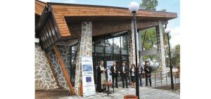 “Sustainable management of the National Park Pirin” and forest reserve “Tisata”, The center can be found just up from the Kempinski Hotel on Pirin Street.
New Mobile app released via the Pirin National Park – The application is free of charge and works both offline and without cell phone network coverage, which is important when hiking in the mountains where there is no coverage.
It provides information about where the tourists are and what the distance to the nearest shelter, hut or natural landmarks is.
The only condition required to use the app is to have a smartphone with GPS.

It is available on Google Play and in the apple store search for PSS or ПСС. https://play.google.com/store/apps/details?id=eu.vmobile.pss
Huts
Banderitsa Hut
THE NEW HUT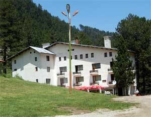
The new hut Bunderitsa represents a solid three-storey building with total capacity of 95 beds distributed in double, triple and four-bed rooms, as well as dormitories which dispose of 7 up to 13 beds.
The hut is situated on the left bank of the Bunderitsa River, at 1810 m above the sea level. There are outside and inside WCs and baths.
The hut is electrified and centrally heated. The restaurant and the canteen are on the first floor. At the tourists’ disposal there is also a TV-set and games spot. There is a small ski-drag in the area.
THE OLD HUT
The old hut is located in the immediate proximity to the new one. It is a solid two-storey building with total capacity of 73 beds allocated in rooms with 10, 11 and 12 beds and plank-beds, with inside WCs and sinks. The hut is supplied with electricity.
The tourist kitchen and the canteen are situated on the ground floor. The hut accepts tourists during the summer season.
There are in the area massive bungalows with 30 beds. Each bungalow disposes of 3 beds. The WCs and sinks are outside. The bungalows are electrified and heated by electric stoves.
The buffet is located in separate building and offers drinks, souvenirs, foodstuffs and others.
NEUGHBOURHOOD TOURIST OBJECTS
Baikushevata mura (one of the oldest trees in Bulgaria) – 0,10 hours
The Hana cave – 0,15 hours
The peak of Vihren – 2,30 hours
Hut Vihren – 0,30 hours along a marked path or 2 km by an asphalt road
The Kazana shelter – 1,30 hours
The peak of Kutelo – 3,00 hours
The first lift station in the Upleto place – 0,35 hours on foot
The first lift station in the Shiligarnika place – 1,00 hour on foot
Starting point: the town of Bansko – 14 km by an asphalt road or 4,00 hours walking along a marked route.
Host: TS “Vihren” – Bansko, 2, “Vazrajdane” square, phone 9 7443/2683.
Camping Banderitsa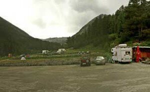
It is located on a large meadow on the left bank of the Bunderitsa River, at 1800 m above the sea level. The terrain represents two grassed terraces with total capacity of 60 tents.It is not electrified. It is water supplied and has WCs without baths.
One can use the restaurant and the buffet of hut Banderitsa.
There is a parking lot.
Neighborhood tourist objects:Hut Bunderitsa – 100 m (0,05 hours), hut Vihren – 0,25 meters along marked path or 2 km by an asphalt road.
Starting point:the town of Bansko – 14 km by an asphalt road.
Host: TS “Vihren” – town of Bansko, 2 “Vazrajdane” square phones: 9 7443/2683
Vihren Hut
Hut Vihren is located on the left bank of the Banderitsa River, at 1950 m above sea level. 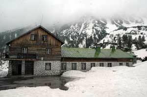 The hut is a complex of two massive two-storey buildings and bungalows that can receive a total of 196 guests and tourists. The tourists can be accommodated in common rooms of 5, 7 and more beds. Two of the rooms offer plank-beds. The bungalows dispose of 3 and 4 beds. There is a seasonal restaurant, which is housed in a building in immediate proximity to the hut. Another building near by houses the tourist kitchen, the canteen and the buffet, which offers drinks, food, goodies and souvenirs. The hut disposes of outside WCs and bathrooms. Hut Vihren is water and electricity supplied. It is heated on solid fuel stoves. Camping in the vicinity is strictly forbidden. There is a convenient parking lot near the hut.
NEIGHBORING TOURIST SITES
Mountain peak Vihren – 2.30 hours
Mountain peak Koncheto via the Kazanite place – 3.30 hours
Todorin vrah peak – 3.00 hours
Ribno Banderishko ezero lake – 0.50 hours
Okoto lake – 0.15 hours
Hut Sinanitsa – 4.00 hours
Hut Banderitsa – 0.30 hours (a 2-km trip along an asphalt road)
Hut Yane Sandanski – 5.30 hours
Hut Kamenitsa – 6.00 hours
Shelter Tevno ezero – 6.30 hours
Hut Demyanitsa – 4.30 hours
Hut Yavorov – 9.00 hours
All mountain trails are well marked. Hut Vihren is a point from the “E-4” European itinerary.
STARTING POINT
Hut Vihren can be reached by starting from the town of Bansko, following a 16-km asphalt road and a 4.30 hours of walk along a well marked mountain trail.
Hut Vihren is managed by Resort complex “Pirin” – Bansko and the “Strajite” Hotel.
Demyanitsa
Hut Demyanitsa is located near the place where the Strajishka, Valyavishka and Vassilashka Rivers join, in a century old coniferous forest, at 1895 m above sea level. 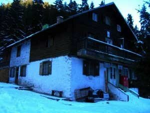 The hut is a massive two-storey building with an attic floor. The hut disposes of five rooms of 5, 8 and more beds and 12 rooms offering plank-beds. The attic floor disposes of a total of 70 plank-beds. A separate building offers the tourists accommodation on 50 spring plank-beds. The 14 bungalows attached to the hut can accommodate up to 42 guests in 3 and 4-bed rooms. Hut Demyanitsa can receive a total of 217 tourists.
If necessary during the summer the hut management can provide tents for the guests in excess. The seasonal restaurant of hut Demyanitsa is located on its first floor. The tourist kitchen and canteen are located in a separate building. There is a pavilion offering drinks, a variety of goodies, souvenirs, etc. The hut has outside WC and bathroom. Hut Demyanitsa is electrified by aggregate and hydroelectric central, it is also heated by solid fuel stoves.
NEIGHBORING TOURIST SITES
Mountain peak Malak Tipitz – 2.30 hours
Mountain peak Izvorets (Kaymakchal) – 2.30 hours
Gorno Strajishko ezero lake (Gazeysko) – 2.30 hours
Voyvodski vrah peak (Gazey) – 2.50 hours
Strajite place – 3.00 hours
Mountain peak Polejan – 3.30 hours (the mountain trails are well marked)
Valyavishki ezera lakes – 2.00 hours (along the marked trail leading to mountain hut Bezbog – Godless)
Ribno Vassilashko ezero lake – 0.45 hours
The Todorini ochi (Todora’s eyes) lakes – 2.30 hours (along the marked trail leading to mountain hut Vihren)
Prevalski ezera lakes – 1.45 hours (along the marked trail leading to mountain shelter Tevno ezero)
Hut Vihren – 4.30 hours
Hut Yane Sandanski – 5.30 hours
Hut Kamenitsa – 5.40 hours
Shelter Tevno ezero – 3.00 hours
Hut Pirin – 5.30 hours
Hut Bezbog – Godless – 5.00 hours (the mountain trails are well marked)
STARTING POINT
Hut Demyanitsa can be reached by starting from the town of Bansko and following a well marked 4-hour mountain trail.
Hut Demyanitsa is managed by Resort complex “Pirin” – Bansko and the “Strajite” Hotel.
Tevno Lake SHELTER
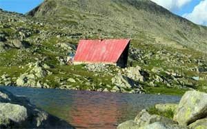 The Tevno Ezero mountain shelter is located near the eastern side of the Tevno ezero lake, at 2512 m above sea level. The shelter is a massive two-storey building with the capacity to accommodate 30 guests. The tourists have at their disposal rooms with plank-beds, located on the second attic floor of the mountain shelter. If necessary the canteen of the mountain shelter can be transformed into a dormitory. The Tevno Ezero mountain shelter is electrified by an aggregate. The shelter is supplied with drinking water from a spring, located just 50 m behind the building. The very lake can too be used for the needs of the tourists. The shelter offers outside WCs. There are no bathrooms. The Tevno Ezero mountain shelter is open for tourists all year round but is only served by personnel during the summer. Camping here is strictly forbidden.
NEIGHBORING TOURIST SITES
Kraledvorski cirque – 1.30 hours
Popovo ezero lake – 2.00 hours
Samodivski vrah peak (Djengal) – 1.20 hours
Mountain peak Momin dvor – 0.40 hours
Mountain peak Kamenitsa – 3.00 hours (the mountain trails are not marked)
Mitrovo ezero lake – 1.10 hours (along the well marked mountain trail leading to hut Pirin)
Prevalski ezera lakes – 1.10 hours (along the well marked mountain trail leading to hut Demyanitsa)
Hut Demyanitsa – 2.30 hours
Hut Vihren – 6.30 hours
Hut Kamenitsa – 3.00 hours
Hut Yane Sandanski – 4.00 hours
Hut Pirin – 2.30 hours
Hut Bezbog – 4.20 hours (the mountain trails are well marked)
The mountain shelter is a point from the “E-4” European itinerary.
STARTING POINT
The town of Bansko is a starting point for the Tevno Ezero mountain shelter. The shelter can be reached after 7 hours of walking along a well marked mountain trail.
The Tevno Ezero mountain shelter is managed by the “Vihren” Tourist Association, seated in the town of Bansko.
Kazana shelter
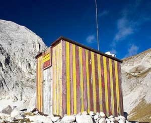 Mountain Shelter Kazana is located on the rocky verge dividing the Golyam and Malak Kazan circuses, at 2445 m above sea level.
The mountain shelter is actually a wooden barrack with metal construction. It disposes of plank-beds for 4 to 5 tourists. The mountain shelter is not served by personnel, it is not furnished, it is not water and electricity supplied. There is no WC. Spending the night here is only admissible in cases of emergency.
NEIGHBORING TOURIST SITES
Mountain shelter Koncheto – 2.30 hours
Mountain peak Kutelo – 1.30 hours
Mountain peak Vihren – 1.50 hours
Hut Banderitsa – 1.30 hours
The mountain trails are marked.
Mountain shelter Kazana is managed by the “Vihren” Tourist Association, seated in the town of Bansko.
Yavorov Hut
Hut Yavorov is located in the Polyanite place in the valley of the Razlojki Suhodol River, at 1740 m above sea level. 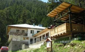
The new hut is a massive two-storey building with the capacity to accommodate 70 tourists in rooms of 2, 3, 6 and more beds and one apartment. The apartment and 10 of the 2-bed rooms have own inside WCs and bathrooms. The rest of the rooms use a common WC on each floor of the hut. The hut is water and electricity supplied, with central heating. It disposes of a restaurant and a buffet, which are open all year round. The buffet offers goodies and souvenirs. There is a hall, entertainment room, VCR, TV-set, amusing games. In proximity to the hut there is a ski track with a ski trail. The hut offers ski equipment.
The old hut is located in immediate proximity to the new one. It is a massive two-storey building with the capacity to accommodate 20 tourists. The hut disposes of 4, 5 and 6-bed rooms using outside WCs. The old hut is water and electricity supplied and heated by electric and solid fuel stoves. The tourist kitchen and canteen are located in a separate massive one-storey building. There is a volleyball playground nearby.
During the summer season the tourists can use bungalows and tents provided by the hut. There is a parking lot for vehicles.
NEIGHBORING TOURIST SITES
Haidoushka cheshma – 0.40 hours
Yavorova polyana – 0.50 hours
Mountain peak Okaden – 1.30 hours
Stapalata – 2.00 hours
Hut Vihren – 9.00 hours
Hut Banderitsa – 8.00 hours
Mountain shelter Koncheto – 4.30 hours
Hut Predel – 5.30 hours
The mountain trails are marked. Hut Yavorov is a point from the “E-4” European itinerary.
STARTING POINT
The town of Razlog is a convenient starting point for hut Yavorov. The hut can be reached after 4 hours of walking along an asphalt road and a well marked mountain trail, or by car – 7 km along an asphalt road to the Betolovo region, then 9 more km along a wood jeep road.
The hut is managed by the “Pirin” Tourist Association, seated in the town of Razlog, 38, “Vazrajdane” Str., telephone number 9 747/ 2256.
Koncheto Shelter
Mountain shelter Koncheto is located on the main mountain ridge southeast of mountain peak Bayuvi dupki, at 2760 m above sea level. 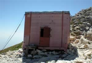
The shelter is actually a wooden barrack, with twin walls, a door and a window. It is attached to the nearby rocks by steel ropes. The shelter disposes of 4 double and 2 single plank-beds and can provide accommodation for 10 – 12 guests. The shelter is only equipped with blankets. There are no personnel, the construction is not water and electricity supplied. There is no WC. Spending the night here is only admissible in cases of emergency.
NEIGHBORING TOURIST SITES
Hut Yavorov – 4.30 hours
Mountain shelter Kazana – 2.30 hours
Hut Banderitsa – 4.00 hours
Mountain peak Kutelo – 1.00 hour
Mountain peak Vihren – 2.40 hours
Hut Vihren – 4.40 hours (via mountain peak Vihren), respectfully – 4.30 hours (via Kazana).
The mountain trails are marked.
The shelter is a point from the “E-4” European itinerary.
Mountain shelter Koncheto is managed by the “Pirin” Tourist Association, seated in the town of Razlog.
Bezbog Hut
Hut Bezbog is located by the northern end of the Bezbojkoto ezero lake, at 2236 m above sea level. 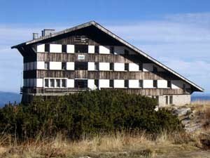
The hut is a massive five-storey building with a capacity to accommodate 160 tourists. The hut disposes of 2 apartments and many 3, 4 and more than 8-bed rooms. The WCs and bathrooms are common, one per each floor.
The hut is electrified and water supplied, with central heating. There is a restaurant, cafe-aperitif, goody buffet, entertainment room, VCR, TV-set, ski equipment. In proximity to the hut there is a sports playground and a ski track with two ski trails. During the summer the hut provides additional accommodation in tents, which can be placed some 100 m south of the hut, by the western bank coast of the lake. There is a concrete platform in front of the tent ground, which is suitable for tables and chairs. The campers use outside WCs and bathrooms. All tourists have at their disposal a tourist kitchen and a canteen located in a massive one-storey building. During the summer that building can be used for accommodation and provides places for 20 guests.
NEIGHBORING TOURIST SITES
Kremenski ezera lakes – 2.30 hours
Mountain peak Bezbog – 1.30 hours
Mountain peak Polejan – 2.30 hours
Mountain shelter Tevno ezero (via the Kraledvorski circus) – 3.40 hours
Samodivski vrah peak (Djengal) – 3.15 hours (the mountain trails are not marked)
Popovo ezero lake (along the marked mountain trail leading to hut Pirin) – 1.15 hours
Hut Pirin – 5.30 hours
Mountain shelter Tevno ezero (via Jelezni vrata) – 4.20 hours
Hut Demyanitsa – 4.15 hours (the mountain trails are marked)
STARTING POINT
Hut Gotse Delchev is a convenient starting point for hut Bezbog. The hut can be reached after 2.30 hours of walk along a well marked mountain trail (or in just 28 minutes by lift).
Hut Bezbog is managed by DF “Socialen Otdih” – seated in the village of Dobrinishte.
Pirin Hut
Hut Pirin is located in the Trite reki region, at 1640 m above sea level. It is a massive three-storey building with a capacity to accommodate 78 tourists. The hut disposes of 4 and 6-bed rooms and common bedrooms with spring plank-beds. There are outside WCs and bathrooms. During the summer the hut can provide additional accommodation in tents for a total of 20-30 guests. 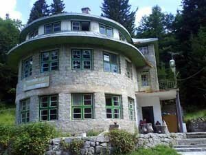
The hut is water supplied and electrified by an aggregate and a hydroelectric central. For heating during the winter the tourists use solid fuel stoves. Hut Pirin disposes of a tourist kitchen and a canteen. There is a seasonal restaurant approximately 150 m away from the hut. The restaurant offers warm drinks and food. It also sells eatables.
NEIGHBORING TOURIST SITES
Hut Malina – 1.45 hours
Hut Popovi livadi – 7.00 hours
Hut Bezbog – 6.00 hours
Mountain shelter Tevno ezero – 4.00 hours
Hut Demyanitsa – 6.30 – 7.00 hours
Hut Kamenitsa – 5.00 hours (via the Solishteto place), respectively 5.30 hours via the mountain ridge between the Kuklite and Zabat peaks
Rojen Monastery – 4.30 hours
Tourist dormitory Rojen – 5.00 hours
Town of Melnik – 5.15 hours
The hut is a point from the “E-4” European itinerary.
STARTING POINT
The town of Melnik is a convenient starting point for hut Pirin. The very hut can be reached after 6 hours of walking along a well marked mountain trail (or by car to the Lopovo place – 28 km along a dirt road and then 1.15 hours of walk). The village of Pirin is another starting point for the hut – 18 km following a road, 13 km of which on asphalt road.
Hut Pirin is managed by the “Pirin Eagle” Tourist Association, seated in the town of Melnik.
Kamenica(Begovica) Hut
Hut Kamenitsa 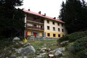 is located on the left bank of the Kozya (Begovishka) reka River, at 1750 m above sea level.
The hut is a massive three-storey building with an attic floor and the capacity to accommodate 90 guests. Hut Kamenitsa offers accommodation in 2, 4, 7 and 8-bed rooms, several common bedrooms and 1 apartment. There are WCs on each floor. During the summer season the hut provides additional accommodation in tents for about 30 tourists. There is a place specially designed for a campsite and also a parking lot for vehicles.
The hut is water and electricity supplied. It provides for its guests heating on solid fuel stoves. The bathroom, the equipped kitchen and the dinning room of the hut are all located on the ground floor. The restaurant of the hut, which works all year round, is on the first floor. There is a buffet, which offers food, goodies, souvenirs.
At the disposal of the guests there are entertaining games, a TV-set, ski equipment, a playground and ski tracks with three ski trails in the area.
NEIGHBORING TOURIST SITES
Mountain peak Kuklite – 2.10 hours
Mountain peak Zaba – 2.50 hours
Mountain peak Yalovarnika – 3.50 hours
Manenkoto ezero lake – 4.35 hours (the mountain trails are not marked)
Mountain peak Kamenitsa – 2.30 hours (the mountain trail is marked to Kozi /Begovishki/ preval ridge)
Hut Pirin – 5.00 hours (via the Solishteto place), respectively 5.30 hours via the mountain ridge between the Kuklite and Zaba peaks
Kuklenskoto ezero lake – 2.00 hours
Mountain shelter Tevno ezero – 3.30 hours
Hut Vihren – 7.00 hours
Hut Sinanitsa – 6.30 hours
Hut Yane Sandanski – 1.30 hours
Hut Bezbog – 7.30 hours (the mountain trails are marked)
STARTING POINT
The town of Sandanski is a convenient starting point for hut Kamenitsa. The hut can be reached along a 29-km road, 21 km of which an asphalt road via the Popina laka place and Cherkovnoto (Turichka cherkva) place. During the summer there is a regular Saturday and Sunday bus line running between the town of Sandanski and the Popina laka place.
Hut Kamenitsa is managed by the “Edelweiss” Tourist Association, seated in the town of Sandanski.
Spano Pole Shelter
Mountain shelter Spano pole is located in the Malko Spano cirque, at 2050 m above sea level. 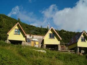 The shelter disposes of 10 one-storey wooden two-bed bungalows. The WCs are outside. There are no bathrooms. The bungalows are electrified by aggregate. The shelter can only be used during the summer. The shelter is only serviced by personnel seasonally. Camping with own tents is forbidden. Fire can be built only at the sites specially designed for that purpose.
NEIGHBORING TOURIST SITES
Hut Vihren – 3.30 hours
Hut Kamenitsa – 3.30 hours
Hut Yane Sandanski – 1.30 hours
Hut Sinanitsa – 1.30 hours (the mountain trails are marked)
STARTING POINT
The town of Sandanski is a convenient starting point for mountain shelter Spano pole. The shelter can be reached along 18 km of asphalt road leading to the Popina laka place and then after 3.00 hours of walk along a well marked mountain trail and dirt road. During the summer there is a regular Saturday and Sunday bus line running between the town of Sandanski and the Popina laka place.
Mountain shelter Spano pole is managed by the “Edelweiss” Tourist Association, seated in the town of Sandanski.
Sinanitsa Hut
Hut Sinanitsa is located just 100 m northeast of the Sinanishko ezero lake, at 2190 m above sea level.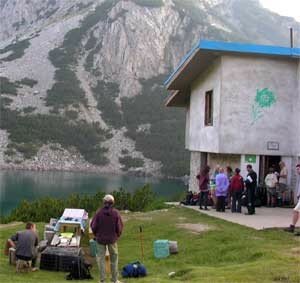
The hut is a massive two-storey building, which has the capacity to accommodate a total of 34 guests in rooms with 9, 10 and 15 two-storey spring beds. If necessary the hut will provide additional accommodation in the canteen.
The hut is water supplied but not electrified. It offers solid fuel stove heating. The fully equipped kitchen and canteen of the hut are located on the first floor.
NEIGHBORING TOURIST SITES
Georgiiski cirque – 2.30 hours (the mountain trail is not marked)
Mountain peaks Sinanitsa and Momin vrah – 1.30 – 2.00 hours (the mountain trail to Sinanitsa is marked)
Cirque Golyamo Spano pole – 1.30 hours
Hut Vihren – 4.00 hours
Hut Kamenitsa – 5.00 hours
Hut Yane Sandanski – 4.00 hours (the mountain trails are marked)
STARTING POINT
The town of Kresna is a starting point for hut Sinanitsa. The hut can be reached along a 24-km dirt road leading to the Peshterata place and then 3.00 more hours of walk along a not so well marked mountain trail. The Sofia-Kulata asphalt road and railway line pass through the town of Kresna.
Hut Sinanitsa is managed by the “Sinanitsa” Tourist Association, seated in the town of Kresna.
Pirin Hiking Routes Map – http://pirinmap.com/index.php/en/